 |
|||||||||||||||||||||||||||||||||||||||||||||||||||||||||||||||||||||||||||||||||||||||||||||||||||
|
|||||||||||||||||||||||||||||||||||||||||||||||||||||||||||||||||||||||||||||||||||||||||||||||||||
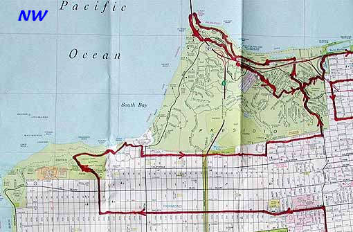
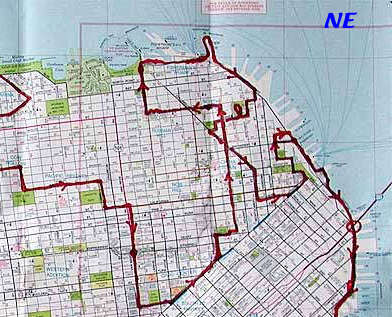
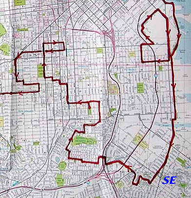
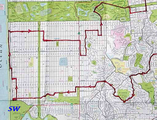
Route Map - ALL - NW
, NE , SW
, SE , (Click
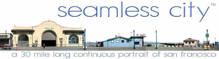
on specific sections of map for more detail) Route It will be a continuous walk through San Francisco, starting and ending at the Bay Bridge . In between I will be traveling through a cross section of the many different kinds of neighborhoods and environments of San Francisco. The route will meander to include many different areas. I mean to include a cross section from the working waterfront and industrial areas to the toniest sections of Seacliff and Pac Heights. It will really be a portrait of the real city, as a whole, not just the tourist attraction.(Actually very little of the tourist attractions) After many years of living here and continuously exploring different neighborhoods I feel that I can present a very rich picture. At present I've plotted a route that will be about 30 miles long. Iincluded neighborhoods are: Embarcadero / Pac Bell Park / Working Waterfront / Dogpatch / The Mission / The Castro / Noe Valley / The Sunset / Ocean Beach / Golden Gate Bridge-Fort Point / Financial District / NorthBeach / Chinatown / Bayview / Bernal Heights...etc. |
|||||||||||||||||||||||||||||||||||||||||||||||||||||||||||||||||||||||||||||||||||||||||||||||||||
|
|
|||||||||||||||||||||||||||||||||||||||||||||||||||||||||||||||||||||||||||||||||||||||||||||||||||